Routes 5 & 6
Wick
Route 5 (the North loop)
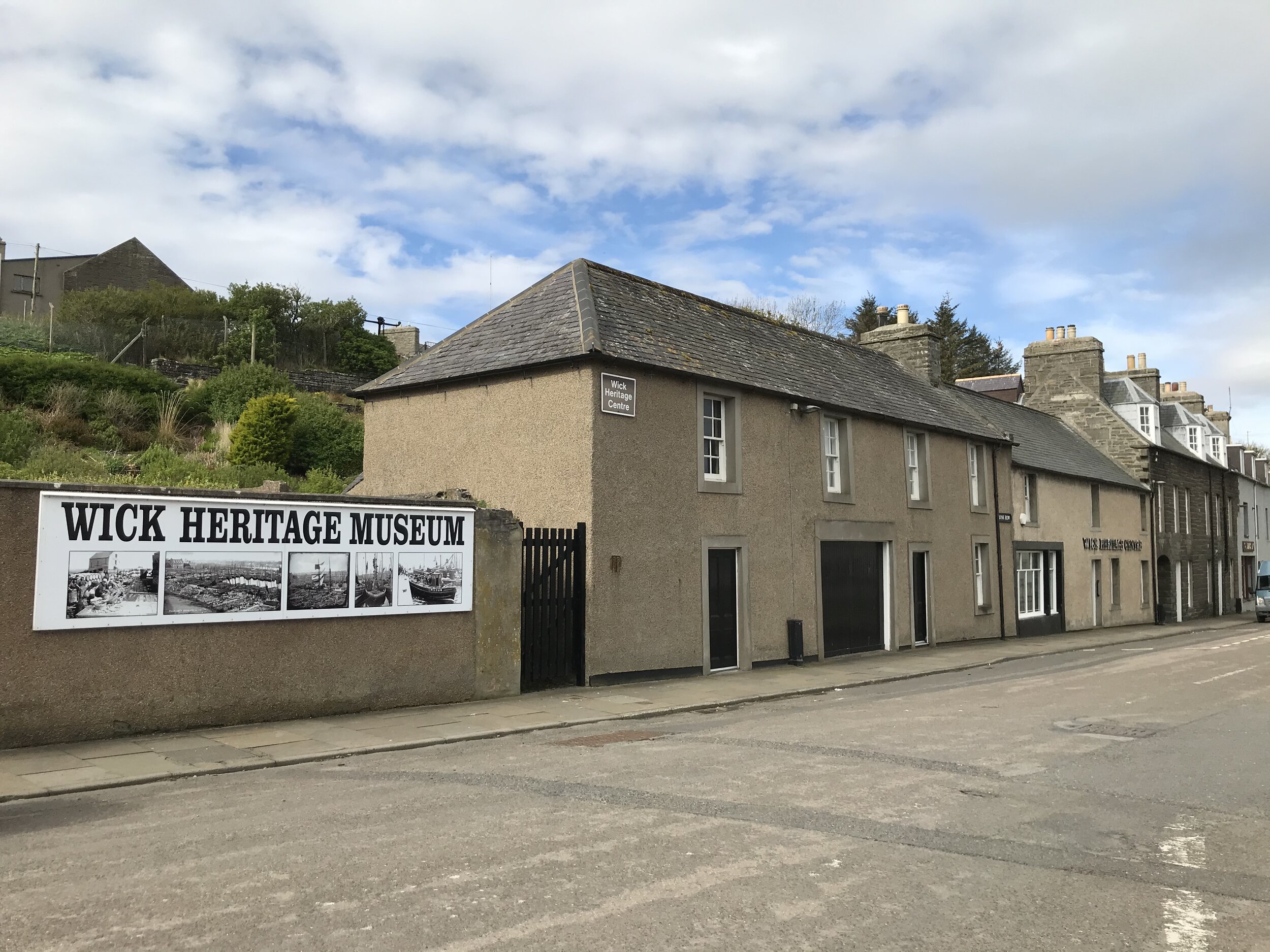
19. Wick (from the Norse ‘Vic’, a bay). Local saints: Fergus (6th or 8th century), Ninian (6th century) Francis
Wick has been a Royal Borough since 1589 and is the administrative centre of Caithness. The North loop starts at the Parish Church, dedicated to St Fergus, on the main road at the Northern end of the town.
The original chapel in Wick may have been in the area known as Mount Hooly, now Mount Hooly Terrace off Shore Street, which is a very steep street leading from the end of the pedestrianized centre of the town up to Girnigoe Street. The name may also signify that this land belonged to the bishop. Later a new chapel was built near the present parish church. Papigoe, to the NE of the town was probably also land owned by the bishop.
The current St Fergus church contains a replacement for the effigy of the saint mentioned in Calder’s History of Caithness (see the entry for Fergus above). This had been kept in the local museum (in the library) but was moved to St Fergus church recently when the library was moved to the new High School. With it is the baptismal font from the original St Fergus church. This had been given to the United Free Church but ended up in their garden, then in a field being used for animal drinking water. The shape of the rim suggests that it had been used for many years as a sharpening stone for knife blades.
46. Killimster, Local saint: Duthac
From St Fergus church, take the Thurso road – the B876 – for five miles to Killimster. Pull into the lay-bye on the left just at the top of a rise (there is a group of modern houses to the right). You are now looking over Killimster Moss to the South, sometimes known as the Kirk Moss, where St Duthac’s chapel (or Dudoch’s as it was known locally) was. The chapel was built on some raised ground about a mile West of Loch Killimster and near the Burn of Kirk Stains. It is now surrounded by very boggy ground and is not readily accessible.
9. Olrig, Local saint: Drostan; Colum
Having admired the view and wondered at the dedication of those early saints who lived and worked here so long ago, continue towards Castletown. On the edge of the village, turn left with the primary school on your right and drive ??? miles on a single track road. Take the first turn right and continue a short distance to Olrig graveyard on the left. At the entrance/in the graveyard was a chapel dedicated to Drostan/Trothan. This was built in 1663 to replace the chapel near the shore on the Dunnet Links, dedicated to St Coomb (or Colum or Colm – see next entry). It was used as the parish church until 1840. A socketed plinth of an ancient churchyard cross is on the south side of the building beside the Witches’s grave. This grave has a concrete border identifying it. It is reputed to never dry out as the witch was actually a seal woman (or selkie in the local dialect). Another legend is that Drostan, or Trothan as he is known at this site, is buried on the same site, which would explain the cross.
Traces of a building which may have been a monastery and/or nunnery have been found in the field to the East of the graveyard.
10. Dunnet Links Local saints: Colum; Colm
Return to the main road, turn left and follow the curve round to the junction with the Thurso-John o’ Groats road – the A836. Turn right and continue past the garden centre on the right. Ahead is Dunnet Bay. As you drive along the edge of the bay, known as the Dunnet Links, you will notice sand dunes on either side of the road. Some of these are just that – sand, but some contain ancient settlements, possibly equivalent to Scara Brae on Orkney. There is also a post-reformation manse that was completely covered by sand during a storm and a chapel site dedicated to Colum. The manse may have been built on the site of a chapel dedicated to St Colmof Buchan, a follower of Drostan.
Towards the East end of the bay and on the right is Dunnet Forest. If you have a dog in the car, this is an excellent place to give it some exercise, especially if the weather does not lend itself to a walk on the beach. Just past the forest entry and on the left is Dunnet Caravan Park and the Seadrift Centre. The Centre is run by the Highland Council Ranger Service and contains displays on local geology, flora and fauna. It is only open in the Summer.
11. Dunnet and area, Local saints: John; Mary
Continue past the caravan site to Dunnet village. Just before the hotel and behind its car park is Dunnet Church of Scotland parish church. This building dates back to the 15th century and is similar to the churches at Reay and Canisbay. While one source says that it was dedicated to Anne, it seems more likely that the dedication was to Mary as the local fair is still known as the Marymas Fair and until recently was held on the first Saturday after the Feast of the Assumption of Our Lady on 15th August. It is now held on the last Saturday of August to ensure that it does not clash with the school holidays.
Dedications to Mary and the apostles suggest a post-Celtic beginning or a re-dedication. We have seen that the area to the West of Dunnet is linked with Drostan, Colum and Colm, so perhaps they could also lay some claim to the village itself.
12. St John’s Loch, Local saint: John the Baptist
Just past the village lies St John’s Loch. Local tradition says that it is so called after John the Baptist because its waters were used for baptisms. It is one of several local places that was thought to have healing powers and there was a tradition of walking round the edge of the loch three times on Midsummer morning and praying for a cure. The edge of the loch is still a right of way but is used today by fishermen rather than penitants (to fish, you need a permit, obtainable at the hotel or fishing tackle shop on the edge of the village). Access can be gained via either the new harbour on the North shore, off Hunspow Road (B855), or the old harbour on the South side, off Corsback Road (A836). There was a chapel at the South East end of the loch now only a slightly raised area. It can be accessed by following the edge of the loch in an easterly direction from the old harbour. The loch drains by a small burn that runs close to the church and into the bay. Traces of an early settlement have been found near the mouth of the burn.
In order to include Dunnet Head in your travels, you need to turn left just past the hotel and distillery and follow the B855 round the sharp bend and along to Brough with St John’s Loch on your right. At Brough, turn left and continue to the end of the single-track road.
On the west side of Dunnet head is an inlet known as Chapel Geo. Here a hermit built himself a shelter and chapel. If you are interested in visiting this site, you will need stout walking boots and preferably a map. As you will be walking along the edge of a cliff, please keep all pets and children close at hand and do not attempt the walk in poor visibility or a strong wind. Having said that, it can be a lovely walk! Take the B855 from the village but, instead of going round the curve, go straight ahead following the sign for Mary Anne’s cottage. At the T junction, turn up the hill and park the car at the end of the road. Follow the path to the top of the cliff and, instead of going down to the Peedie Sands, follow the cliff edge to your right, past the Loch of Bushta until you come to an indent in the cliff face – Chapel Geo.
Return to Brough and continue along the coast through Ham, Scarfskerry, Harrow and Mey. On the left at Ham are the ruins of chambered cairns, called souterrains on some maps. These have a unique structure and their description is reminiscent of Tolkein’s hobbit houses. Once past Harrow, you will see the Castle of Mey on the right. Now a Trust and open to the public in the Summer, this was for many years the holiday home of the Queen Mother. It originally belonged to the Sinclair family who also owned the estates around Roslyn Chapel in East Lothian and there are various legends linking the two buildings.
13. St John’s Point, Local Saint: John
Once past the castle, the promontory ahead is St John’s Point and the remains of a chapel and wall can be seen. Access is possible by parking at the corner where the road takes a sharp turn South and walking back through the field. The usual warnings about damaging fencing and livestock apply.
14. Canisbay, Local saint: Drostan
From St John’s point the road joins the A836 and passes through Gills to Canisbay. The third of the county’s pre-Reformation churches stands at the side of the road. The building is usually open to the public during the summer. It is built on the site of an ancient chapel dedicated to Drostan, and there are records of it going back to 1222. Drostan belonged to the 6th century and is the most-named saint in Caithness, suggesting that Canisbay was an important centre.
15. John O’Groats, Local Saint: Mary
From Canisbay, continue through Huna to the T junction. Turn left to John O’Groats. This was thought for many years to be the most Northerly point on the British mainland but more modern measuring techniques have re-allocated this honour to Dunnet Head. However it is still the end of the road – or the beginning, depending on your direction of travel. So do spend some time here before moving to the site of St Mary’s chapel. There are two approaches to this site. There is a footpath along the coast in an Easterly direction from John O’Groats but this is often obscured by weeds and general rubbish. So you might prefer to go back to the T junction and turn left. The chapel was sited at the far end of the beach. As you walk towards it, look for the rare cowrie shells (known locally as Groaty Buckies).
On a clear day, it is worth continuing your walk up the hill towards the lighthouse. Then follow the cliff edge (but not too close!) for a spectacular view of the Stacks of Duncansby. A short distance along is a geo whose cliff faces teem with bird life.
16. Freswick, Local Saint: Modan
On returning to the main road, take the A99 South to Freswick with its sweeping bay. Here there is a comparatively modern (about 350 years old) chapel (and mausoleum?)built on the site of an ancient chapel dedicated to St Modan. How to access it? The original chapel was much venerated and local people continued to practice ‘popish rites’ here long after the Reformation (see ‘Lest we Forget’ p. 101 and others.)
17. Ackergill, Local Saint: Drostan
From Freswick, continue on the A99 (past the museum?) to the junction with the Thurso-Wick road. To the left just before the junction is Ackergill bay, where there was a chapel dedicated to Drostan. (see notes on clan feud) (access?) At the junction, turn left towards Wick. Turn left into Henrietta Street and follow the road signs for Papigoe. They will take you right onto Girnigoe Street and then left onto Willowbank, which takes you out of the town and towards Staxigoe and Papigoe.
18. Papigoe, Local Saint: Ninian
St Ninian’s chapel was situated on the cliff edge. Some researchers believe that this chapel was actually situated closer to the centre of town at the lower bridge, but the name ‘Papigoe’ suggests church-owned land and is a more probable site. The dedication to Ninian does not necessarily mean that Ninian himself visited Wick although some researchers argue that he could have done so while returning from a mission to Orkney and Shetland.
Return along Willowbank and take the Scalesburn road to the left down to the lower bridge, take right at the mini roundabout and again at the next mini-roundabout, follow the road across the bridge, through the traffic lights and round the corner to take you back to St Fergus Church, your starting point.
Nunnery at Cloisters, Wick = dedication to Francis
Route 6 (the South loop)
19. Wick, Local Saints: Fergus, Ninian
The start point for this route is the same as for the Northern loop – St Fergus church. This time, head towards the town centre. At the mini roundabout, turn 2nd left up the hill and past the hospital on your right. At the traffic lights, turn right towards Thurso on the A882 and drive two miles to the village of Haster.
47. Haster, Local Saint: Cuthbert
St Cuthbert came from the borders and is best known as the Prior and Abbot of Lindisfarne. The site dedicated to him lies 200 yards ESE of Upper Haster farm house at the lower end of a cultivated field on the Burn of Haster and about 100 yards W of the Achairn burn.
48. Watten, Local Saints: Katherine, Bridget, Fumac, Magnus, Tarlogan
From Haster, continue on the A882 to Watten. This seems to have been an important centre as it had a joint convent and monastery, with holy well, dedicated to St Katherine. It was West of the manse. Watten may have been a cross roads for travellers going to and from Canisbay and Wick via Spittal.
Area called Pennyland, to the South East of the village, suggesting that it was owned by the church.
Chapel, graveyard and well at Clow on the Scouthal Burn would have been the site dedicated to Mary, as identified on the HER map.
St Fumac’s Fair presumably took place at Markethill just off the B870
Chapel just South of Didhall House in the area of Dunn may have been the chapel of Dine dedicated to St Fumac. Neither Dine nor Dinet are marked on Landranger maps, so we can only assume that they are corruptions of Dunn – or Dunn is a corruption of them.
St Fumac: Also at St Fumac’s Fair at Dinet and at Chapel of Dine, both on the outskirts of Watten, Caithness.
[Magnus] is commemorated at Banniskirk by Watten, Shebster and Spittal. Banniskirk may be a corruption of his name.
[Mary] a well and burial place at Scouthal, Watten and at Marykirk of Sibster, Wick. The baptismal font from the Sibster chapel is at Stirkoke House. For long after the Reformation, people would visit this chapel on the first Sunday after the new moon.
[Tarlogan] In Caithness, he is remembered at Watten
On entering the village, take the right turn onto the B870. At the sharp corner, a narrow road goes off to the left to the site of the chapel at The Clow on the banks of the Scouthal Burn. Continuing a short distance on the B870, the area of Wester-Watten is on the right at the edge of Loch Watten but Wester-Watten Moss is further South, to the right at the end of the track going past Scouthal and The Clow. One of these sites was where a fair used to be held around the time of the feast-day of St Magnus on 16th April, known in the Middle Ages as Magnusmas. This suggests that it was on a pilgrimage route to and from St Magnus Cathedral on Orkney. Assuming that the pilgrims were meaning to pass through Spittal, they could have passed through either site as there are chapels at The Clow and at Dunn, along the loch-side from Wester-Watten. We are following the B870, which by-passes both of these areas. As it moves inland away from the village, it takes sharp left and right turns. The second road on the right after these turns leads to Markethall and the area of Dunn.
49. Ballachly by Achavanich, Local Saint: Triduana
Continue on the B870 until it joins the A9 at Mybster, just South of Spittal. Turn left and follow the A9 to Achavanich, which is clearly signposted. Take the single-track road to the left and park at the shore of Loch Stemster. Admire the standing stones, then turn and take the track along the West side of the loch, branch left again and continue to the ruined graveyard at Ballachly. Here is the site of the ‘resting place’ of St Triduana where Bishop John was cured of blindness. St Triduana has a well authenticated grave in Edinburgh, so the site at Ballachly is not her grave but may have had a relic of her buried there.
50. Rangag, Local Saint: Ciaran
Continuing a short distance on the A9 Southwards you will see Loch Rangag on your right. There are the remains of Greystell Castle clearly visible on a spit of land not far from the road. This area is associated with St Ciaran, who is also linked with Latheron, and the inland areas around the heads of the Thurso and Rumsdale rivers.
22. Latheron, Local Saint: Curitan, Ciaran
There was a chapel between the road and the sea, where the road curves towards the sea on its way to Latheron.
At this point, the route goes North but the traveller might want to take a diversion South a few miles to Dunbeath where there is a heritage museum, tea room and toilets. A short distance up the river is the House of peace, site number 23.
21. Lybster, Local Saint: Mary
There was a chapel dedicated to Mary at the harbour.
20 Ulbster, Local Saint: Martin
The Ulbster stone is now kept in Caithness Horizons, Thurso. The old Thrumster Railway Station is now a museum.
19. Wick, Local Saints: Fergus, Ninian, Francis, Cuthbert
As you approach the centre of the town, you will pass the hospital on your left. At the bottom of the hill is a mini-roundabout. Go ahead onto Bridge Street and follow the road through the town to your starting point at St Fergus Church.
Optional extra – turn right at the mini-roundabout, park wherever is suitable and walk to the gable end of the MacKay’s Hotel, which is on Ebenezer Street, the shortest street in the world.
Another optional extra – take the first turn to the left after the traffic lights and park at the car park on the riverside. On the hill behind the hotel is St Fergus church, your starting point. If you have the time, and the weather is reasonable, you can walk up the North bank of the Wick River to the point where the Achairn Burn (which passes under the bridge at Haster) joins the Wick River. Just above the river bank is the remains of St Mary’s chapel (need more details of site). The site can also be reached by leaving Wick on the Castletown road and taking the B874 Sibster road. Past Altimarlach Farm and just before Sibster Cottages, there is a track to the left (where to park the car?). Follow it to the river, taking due care when crossing the railway line, and the site of the chapel is near a fence on your right above the river bank. (check if still passable)